Abstract
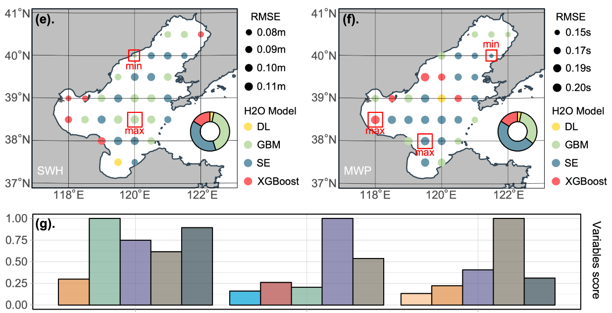
The rational assessment of regional energy distribution provides a scientific basis for the selection and siting of power generation units. This study, which focused on the Bohai Sea, set 31 research coordinate points in the Bohai sea for assessing the potential/trends of wave energy flux (WEF). We applied a point-to-point time series prediction method which modelled the different geographical coordinate points separately. Subsequently, we evaluated the performance of three traditional machine learning methods and three automated machine learning methods. To estimate WEF, the best model was applied to each research coordinate points, respectively. Then, the WEF was calculated and predicted based on the data of MWP, SWH, and water depth. The results indicate that, for all coordinates in the Bohai Sea, the H2O-AutoML algorithm is superior to the other five algorithms. Gradient boosting machine (GBM), extreme gradient boosting (XGBoost), and stacked ensemble models yielded the best performance out of the H2O algorithms. The significant wave height (SWH), the mean wave period (MWP), and the WEF in the Bohai Sea tended to be concentrated in the center of the sea and dispersed in the nearshore areas. In the year 2000, 2010, 2020, and 2030, the maximum annual average WEF at each research coordinate in the Bohai Sea is around 1.5 kW/m, with a higher flux in autumn and winter. In summary, the results provide ocean parameter characterization for the design and deployment of wave energy harvesting devices. Moreover, the automated machine learning introduced herein has potential for use in more applications in ocean engineering.

